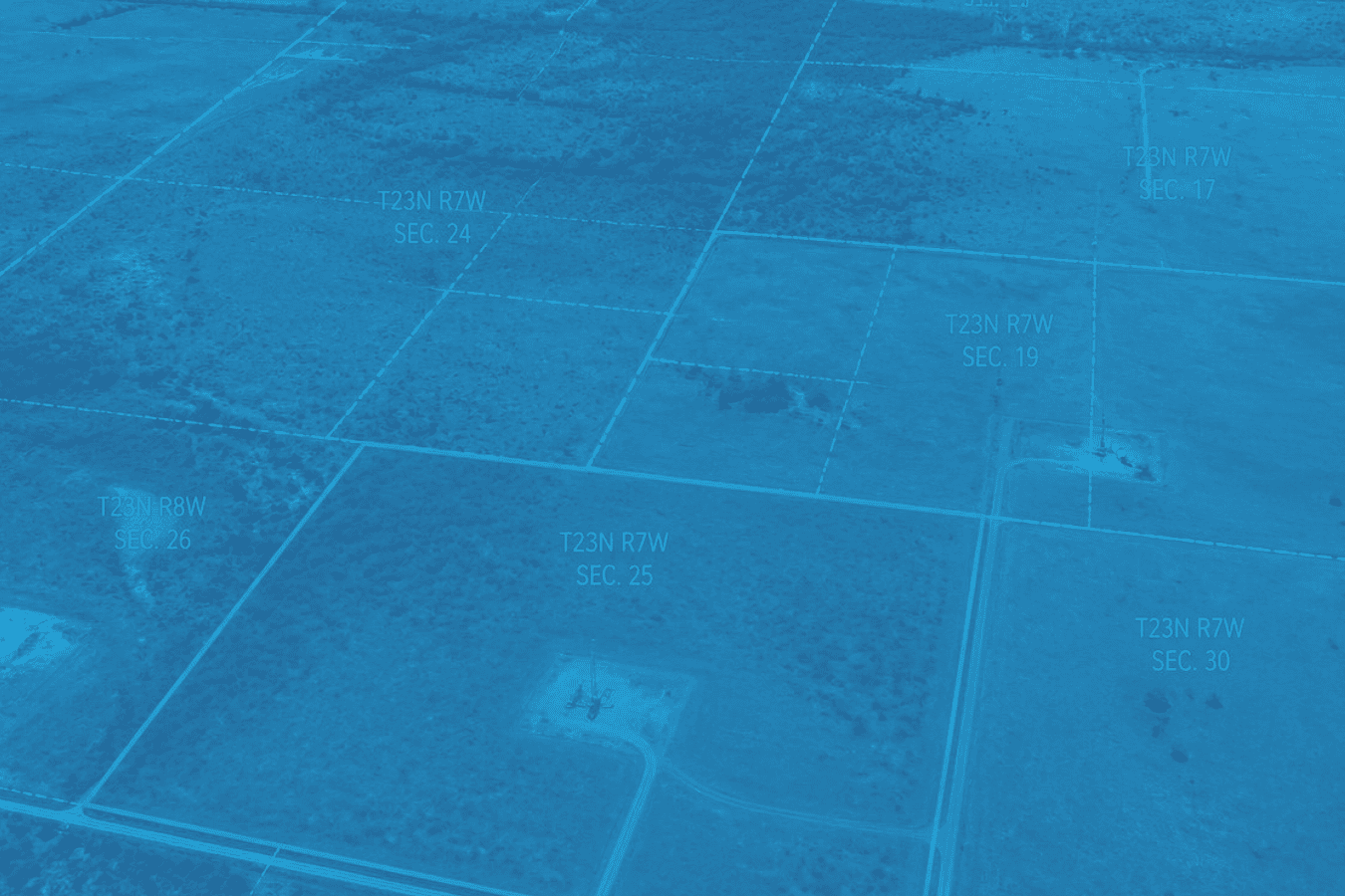
A deed that reads “320 acres, more or less, out of the H&TC RR Co. Survey, Abstract 412, Reagan County, Texas” tells you exactly where your minerals are — if you know how to read it. Most heirs do not, and that is the reason a shoebox of family paperwork often sits untouched for years while wells produce nearby.
This guide walks through the free public tools that translate a Texas or Oklahoma legal description into a shape you can see on a map, in the order you should use them. You will finish with a repeatable process and a short list of the traps that catch first-time researchers. If you have recently inherited minerals and are not sure what you own or where it is, read Just Inherited Mineral Rights? Here Is Where to Start before working through the steps here.
Read the Deed First: Survey, Abstract, and Varas
Before any map is useful you have to decode the language on the page. Texas never adopted the federal section-township-range grid used across most of the western United States. Instead, Texas land is described by original land grant surveys, each identified by a survey name — often the original grantee, a railroad, a colonist, or an empresario — and an abstract number assigned by the county. “H&TC RR Co. Survey, A-412” means the Houston and Texas Central Railroad Company survey, abstract 412, in whatever county the deed names. The abstract number is county-specific, so A-412 in Reagan County is a different tract than A-412 in Midland County.
Older Texas deeds also use varas — a Spanish colonial unit of measure — for metes-and-bounds calls. One vara equals roughly 33.33 inches, or about 2.778 feet. A call of “1,900 varas” is therefore about 5,278 feet, or just under a mile. If your deed reads “thence north 1,900 varas to a stake,” you will need that conversion before you can sketch the tract or compare it to a modern plat.
Oklahoma is simpler on this front. It uses the standard Public Land Survey System, so tracts are described by section, township, and range — for example, “NE/4 of Section 14, Township 6 North, Range 5 West.”
Write down every element from the deed before you open a browser: county, survey name, abstract number, section-township-range for Oklahoma tracts, acreage, and any adjoining landowners or physical monuments named in the description. You will use all of it. For a broader guide to researching mineral ownership at the county level, read Valor’s courthouse mineral research guide.
Step 1: Start With the RRC Public GIS Viewer
The Texas Railroad Commission’s public GIS Map Viewer is the fastest way to see wells, leases, and survey boundaries overlaid on aerial imagery. It is free, requires no login, and covers every county in the state. Search by county and abstract number, or zoom to the county and toggle the survey and abstract layers to see the grid of original grants. Once you find your abstract, turn on the wells layer to see permitted, producing, and plugged wells inside it — often the first confirmation that your family’s tract is or was under active development.
The RRC viewer is authoritative for wells and permits but only approximate for survey boundaries. Original surveys were run with chains and compasses in the 1800s, and modern GIS shapefiles are best-fit reconstructions, so expect the lines to drift from where a modern professional survey would place them. Use the viewer to locate the general area, then move to the appraisal district for a tighter picture.
For Oklahoma, the equivalent starting point is the Oklahoma Corporation Commission’s well records combined with the BLM’s General Land Office Records site, which lets you look up any section-township-range and pull the original federal patent. For a plain-language guide to reading permit and drilling activity once you have located your tract, read How to Read Oil and Gas Activity on Your Acreage.
Step 2: Cross-Check the County Appraisal District
Every Texas county has a Central Appraisal District that maintains parcel-level maps for property tax purposes. These maps are usually more current and more precise than the RRC survey layer because they are maintained for taxation, not historical reference. Search the appraisal district site by owner name or by abstract number. A hit will return a parcel record with acreage, a legal description, and a plat showing the tract outlined against neighboring parcels.
Two things to verify at this stage. First, confirm the acreage roughly matches the deed. A deed calling for 320 acres but an appraisal district parcel showing meaningfully less suggests either a partial conveyance somewhere in the chain of title or a boundary correction — either of which needs investigation before you rely on the map.
Second, confirm the owner name. If the appraisal district still lists a great-grandparent who died decades ago, the surface has likely been sold off but the minerals may still belong to the family, since Texas allows severed mineral estates to pass separately from surface. This is one of the most common patterns Valor’s mineral management team sees, and it is exactly why professional mineral work starts with a clean title review. If the interest appears to still be titled in a deceased relative’s name, read Inherited Minerals With No Paper Trail before proceeding.
Step 3: Use the Texas GLO and Oklahoma Federal Records for the Origin Story
The Texas General Land Office maintains the original patent files for every survey in the state, most of them scanned and searchable through the GLO’s Land Grant Database. Pulling the original patent gives you the field notes, the sketch the surveyor drew in the 1800s, and the name of the original grantee. This matters for resolving conflicts between adjoining surveys — which overlap more often than you would expect — and as the ultimate authority when a modern description references “the original H&TC survey line.”
For Oklahoma tracts, the BLM General Land Office Records site is the federal equivalent. Search by state, county, and section-township-range to pull the original homestead patent or railroad grant. Oklahoma’s Public Land Survey System grid is stable and well-documented, so once you have the correct section-township-range from the deed, locating the tract on a modern map is largely mechanical. The complication in Oklahoma is usually not finding the tract — it is untangling fractional mineral interests that have been divided across generations of heirs.
Common Traps: Duplicate Names, Obsolete Lots, and Re-Surveyed Abstracts
A few patterns cause more grief than any others.
Duplicate survey names. Texas has multiple “H&TC RR Co.” surveys because the railroad received grants across dozens of counties, and there are multiple surveys in the same name because common names appear throughout the historical record. The abstract number plus the county is what makes the description unique — never rely on the survey name alone.
Obsolete lot or block numbers. Many rural Texas subdivisions from the early 1900s were platted, sold, and then vacated or re-platted decades later. A deed referencing “Lot 7, Block 3, Sunset Acres” may point to a plat that no longer legally exists, in which case you need the original plat filed at the county clerk to reconstruct the boundaries.
Re-surveyed abstracts. When a county discovers a gap or overlap between adjoining original surveys, it sometimes creates a new abstract number for the corrected area. An old deed will reference the historical abstract. The appraisal district will show the modern one. Both describe the same ground at different points in history.
Obsolete physical monuments. Deeds that reference “the large post oak” or “the fence corner” are legally valid but functionally ambiguous if those features no longer exist. Resolving them usually requires a professional surveyor or an experienced landman. Valor’s team of certified professional landmen and Certified Mineral Managers works through these situations every week.
When to Stop and Call a Professional
The free tools above will take most owners a long way. Stop and bring in professional help when:
The survey name and abstract number do not appear in any of the databases above — this usually means the original grant predates the current county’s organization and the records are in an archived predecessor county.
The deed describes adjoining owners or monuments rather than a survey name and abstract, and those references are not resolvable from modern records.
The appraisal district shows meaningfully less acreage than the deed and the chain of conveyances is unclear.
You have located the tract but found a well or lease on it that does not match any division order or royalty check in your records.
In each of these cases, a CPL running a title search from the original patent forward is the right next step — not more time in the free databases. For context on what that process looks like and what it costs, read Attorney, CPA, Landman, or Mineral Manager: Who to Hire for What.
Valor has recovered more than $32 million for mineral owners across roughly 500,000 wells in 32 states, and most of that work started with someone holding a deed they could not read. If you have gone as far as you can on your own, Contact Valor and our team will take it from there.
Contact Valor Today
Locating a mineral tract is step one. Confirming the ownership is clean, finding out which wells are producing from it, and getting paid are steps two, three, and four. Contact Valor today for a free, no-obligation mineral asset review — our mineral management team of CPAs, CPLs, and Certified Mineral Managers will locate your tract, run the title, identify any wells or operators connected to it, and tell you what you actually own before you respond to any offer or sign any document. We handle mineral ownership verification for owners across Oklahoma, Texas, and 30 other states.
The information provided by Valor in this blog is for general informational purposes only and is not intended to provide specific recommendations or legal or tax-related advice. This blog should not be used as a substitute for competent legal advice from a licensed attorney in your state.
Key Takeaways
- Extract every element from the deed — county, survey name, abstract number, section-township-range for Oklahoma, and acreage — before opening any map tool.
- Convert varas to feet at 2.778 feet per vara when working with older Texas metes-and-bounds descriptions. A call of 1,900 varas is just under a mile.
- Use the RRC public GIS viewer first for general location, then the county appraisal district for parcel-level detail, then the Texas GLO or BLM for the original patent.
- Never rely on a survey name alone — the abstract number plus the county is what makes a Texas legal description unique.
- If the appraisal district shows meaningfully less acreage than the deed, or if you find a well on your tract with no matching royalty check, stop and bring in a professional title search before proceeding.